 ClimWeb Documentation
Satellite Imagery Settings
Purpose
This panel controls which satellite imagery layers appear on your website’s public Satellite Imagery page, sourced live from EUMETSAT’s Meteosat Second Generation (MSG) satellites. You can add up to 5 layers.
To open it: Settings → Satellite imagery setting.
Screenshot
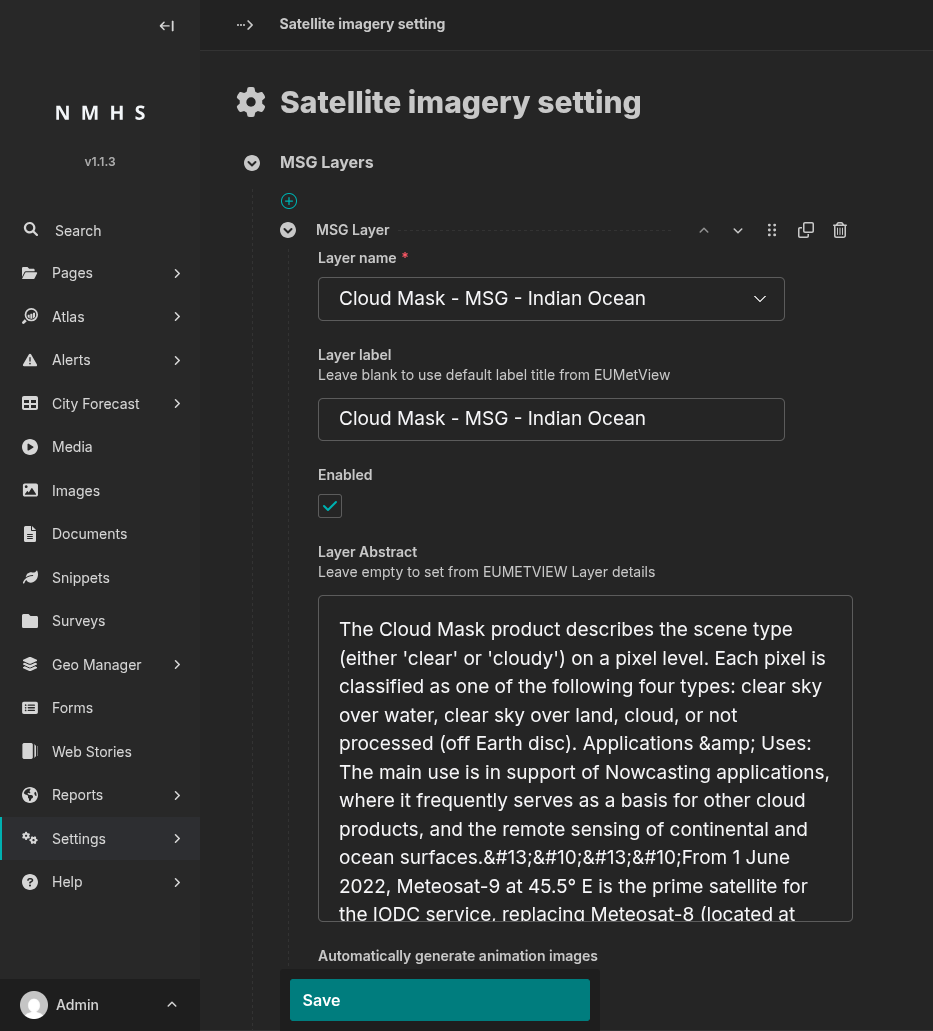
Field Reference — MSG Layer (one block per layer)
Field |
Type |
Required |
Description |
|---|---|---|---|
Layer name |
Choice |
Yes |
Pick the satellite layer to show, from the list EUMETSAT currently publishes. |
Layer label |
Text |
No |
The name shown to visitors on the public site. Leave blank and ClimWeb will fill in EUMETSAT’s own title for the layer once you save. |
Enabled |
Boolean |
No (default: on) |
Turn off to temporarily hide this layer from the public site without losing its settings. |
Layer Abstract |
Text (multi-line) |
No |
A short description shown alongside the layer. Leave blank and ClimWeb will fill in EUMETSAT’s description once you save, where one is available. |
Automatically generate animation images |
Boolean |
No (default: off) |
Builds a looping animation from this layer’s imagery throughout the day, shown to visitors as an optional playback on the layer’s map. |